On the Water… and Below
Water Trails
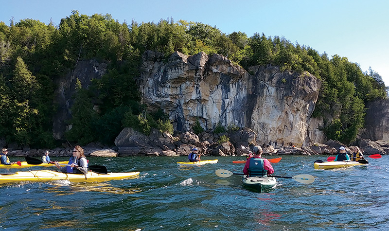
Lake Champlain Paddlers’ Trail
 Launched in 1996, the Lake Champlain Paddlers’ Trail links access sites and camping for paddlers along the shorelines and islands of New York, Vermont and Québec. The Lake Champlain Committee (LCC), a bi-state membership supported non-profit advocacy organization, manages the trail. The LCBP, along with other partners, provided seed funding and technical assistance to help LCC launch the trail, develop trail signs and publish the first guidebook in 1998. LCC produces an annual guidebook that is available through membership.
Shelburne Bay Interpretive Water Trail
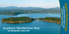 This water trail interprets 11 sites of natural and/or cultural significance. With LCBP funding, the Chittenden County Regional Planning Commission (CCRPC) created the Shelburne Bay Interpretive Water Trail Guide.
The Narrows Interpretive Water Trail
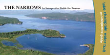 This portion of Lake Champlain embraces all chapters of local history—from unique geologic formations and Native American territories to shipwrecks and “Champ.” An LCBP grant funded Lakes to Locks Passage and Essex County New York’s Champlain Valley Heritage Network to create the Narrows Interpretive Water Trail guide.
Northern Forest Canoe Trail
The Northern Forest Canoe Trail is a 740-mile paddling route that links the waterways of New York, Vermont, Québec, New Hampshire, and Maine. LCBP has supported several project along the trail, most recently an initiative to develop signage to educate paddlers about the spread of invasive species.
Underwater Exploration
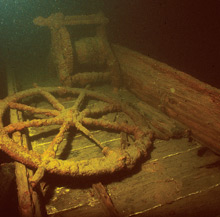
The Sloop Island Canal Boat rest under 90 feet of water near Charlotte, VT. Photo: Lake Champlain Maritime Museum
The Sloop Island Canal Boat rests under 90 feet of water near Charlotte, VT. Photo: Lake Champlain Maritime MuseumLake Champlain and Lake George contain one of the best collections of shipwrecks in North America. These shipwrecks represent every era of human activity from prehistory to military conflicts to the commercial era of the 19th century when schooners, steamboats, canal boats and barges crowded the waterways. There are nine designated dive sites in Lake Champlain’s Underwater Historic Preserve System; one in New York and eight in Vermont. The State of New York has also designated three shipwreck sites in Lake George. Hundreds of SCUBA divers visit the preserves each year; non-divers can experience the wrecks through the Virtual Diver Kiosk at the Lake Champlain Maritime Museum. Shipwrecks are marked with yellow mooring buoys and include underwater interpretive signage. Booklets provide specific information about each wreck’s history, features of interest, and other pertinent diving information. The preserves encourage awareness and stewardship and enhance recreational opportunities for SCUBA divers.
Management issues, degradation of water quality, nuisance aquatics, improved search technologies, and increased accessibility pose difficult challenges to protecting underwater cultural resources. A comprehensive inventory has been critical to addressing those challenges. There is an added urgency in gathering as much information as possible. The proliferation of zebra mussels in Lake Champlain threatens to obscure and, in some cases, destroy important underwater cultural resources. With funding from the Lake Champlain Basin Program, private foundations, and other public and private funding sources, the Lake Champlain Maritime Museum completed an underwater survey in 2004. Approximately 300 square miles of lake bottom was surveyed resulting in the discovery of 75 shipwrecks, including a Revolutionary War era gunboat, located in 1997. The gunboat, later identified as the Spitfire, sank in 1776 during the Battle of Valcour Island.
More on Recreation Resources
View a map of recreation trails in the Lake Champlain Basin Atlas →