Bikeways Maps & Guidebooks
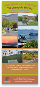
The Champlain Bikeway
 This revised version of the Champlain Bikeway map includes several changes in the basic route that have been made to reflect current road and traffic conditions. This map may be easily printed in 7 sections (which are 8.5 x 11 inches) on a standard printer.
Download the full Champlain Bikeway map →
Download the map in sections →
Island Line Trail
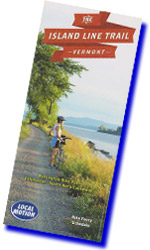 A critical component of the Island Line Trail is the unique bicycle and pedestrian ferry that provides passage across the 200 foot gap where the railroad swing bridge once stood. Check www.localmotion.org for more information.
Download the free Island Line Trail map →
Vermont Bikeways
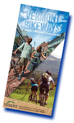 All of Vermont provides excellent opportunities for bicycle touring. More information on recommended great places to ride can be found on the State of Vermont biking page. www.VermontVacation.com .
Heart of Vermont Bikeways
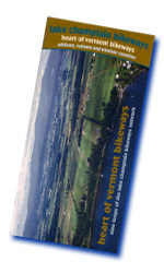 Addison County offers a wide variety of bicycling experiences that have been captured in the six tours detailed in Heart of Vermont Bikeways. The towns of Middlebury and Vergennes offer the desired services necessary to make them ideal launch points for a day of touring. In addition to providing services each town is steeped in historical and natural resource attractions that can focus ones interest for whatever tour may be planned.
The six theme loops are:
Land of Milk and Honey →
Halfway to Heaven →
Town and Country →
Mills to mansions →
Gap to Gap →
Moosalamoo Meander →
Routes near Lake Champlain run north and south and cover rolling terrain with enough hills to provide both a challenge and fun going down. As one moves away from the lake the hills become more challenging and the Gap to Gap ride crosses two mountain passes and has the toughest climbs in the Lake Champlain Bikeways network. The guide provides elevation profiles to allow you to plan the trip that you want without unpleasant surprises.
A map of each individual loop is included in the guide, as well as written directions and an interpretation of the local area and its resources.
The Heart of Vermont Bikeways guide can also be ordered from the Addison County Chamber of Commerce, 93 Court Street, Middlebury, VT 05753. Phone Number: 1-800-SEE-VERMONT.
Free Downloads: (English and French)
Heart of Vermont Bikeways →
Les voies cyclables au coeur du Vermont →
Adirondack Coast Bikeways
 A new and improved edition of Adirondack Coast Bikeways is now available through the Lake Champlain Bikeways Clearinghouse. Updated from the first edition of 1998, this second edition describes 14 thematic loops, eight of which are new to the guide. A treasured link of the overall Lake Champlain Bikeways network, these loops follow paved and unpaved country roads throughout Essex County, New York. The fourteen theme loops are:
Water’s Edge Trail →
Rapid Descent Trail →
River Forks Trail →
Surrounded by Water →
Rolling Reber Rambler →
Joe’s Random Scoot →
Woman Suffrage Way
Coon Mountain Circuit →
Mountain Coast Connector →
Wet and Wild →
Iron to Iron →
Stony Lonesome →
Fort to Fort →
Adirondack Marathon Trail →
The name Adirondack Coast refers to a unique transitional zone, a place where two coasts and two cultures meet, where mountains flow into pastures and the waters of Lake Champlain. Rural country roads will transport you to an era of small farms and villages still defined by their natural setting. The area was not always so peaceful. As you stop to admire breathtaking views of wildlife, keep in mind settler’s efforts to tame the “howling wilderness,” significant military encounters, and the slashing, burning, and pounding of iron mining and other industries of the last century. The hills denuded of trees, air-fouled with smoke, and the river and lake choked with slags, ash, sawdust, and logs are hardly detectable today.
A map of each individual loop is included in the guide, as well as written directions and an interpretation of the local area and its resources.
Free Download:
Adirondack Coast Bikeways →
Northern Adirondack Coast Bikeways
 The Northern Adirondack Coast Bikeways Committee of Clinton County, New York, published an interpretive guide, Northern Adirondack Coast Bikeways. Seven bicycle theme loops include:
Point au Roche Family Ride →
The Flatlander →
Acres of Apples →
The William H. Miner Story →
Monuments, Mills and Music →
Over the Hills and Far Away →
The Climber →
Travel through a landscape characterized by working farms, vast apple orchards, pristine brooks and rivers, and historic monuments and hamlets. The upper Champlain Valley is one of the highest producing apple areas in the United States, second only to regions in the state of Washington.
Prevalent along the loops is a past rich in history. Enjoy several museums and cultural and historic sites in an area where Benedict Arnold led the fledgling United States in its first naval battle at Valcour Island, just south of Plattsburgh in October 1776. In addition, you will see where the U.S. Navy under Commodore Thomas MacDonough, defeated the British Navy at the Battle of Plattsburgh in September 1812, the last American city to be occupied by a foreign army. Lastly, you will travel along the Saranac and Little Ausable Rivers, which powered several grist, pulp, and lumber mills for over 150 years, turning Plattsburgh into a major transportation and shipping hub at the turn of the 19th century.
The guide includes a map and directions for each loop, route conditions, and interpretive descriptions of the area, past and present. Your free copy can be ordered from the Champlain Shores Visitors & Convention Bureau, P.O.Box 310, 7061 Route 9, Plattsburgh, NY 12901, (518) 563-1000.
Free Downloads: (English and French)
Northern Adirondack Coast Bikeways →
La côte nord des Adirondacks →
Town and Country (Chittenden County)
 Located on the east shore of Lake Champlain and less than an hours drive south of the Canadian border, Chittenden County is the major commercial hub of the State of Vermont. Centered around Burlington, the states largest city, the county provides a complete package of facilities and attractions that make it a wonderful place to live or visit. The Burlington Bike Path is nationally known as a wonderful way to enjoy the lake front and it is only a small part of the regional bike path network.
Frequently overlooked is the vast area of the county that remains lovely farmland with classic Vermont scenery just waiting to be explored. This brochure provides suggestions for this kind of exploration throughout the county as well as a unique trip within the many environments of Burlington itself. Six bicycle theme loops include:
Little Country Hills →
Cycle the City →
Covered Bridges →
Mountain Views →
Roads Less Traveled →
North of the Big Hills →
The guide includes segment maps and directions, route conditions, and interpretive descriptions of the area, past and present. It also contains a directory of bicycle-friendly services, sites, and attractions on or near the loop.
Free Downloads: (English and French)
Town and Country →
Les voies cyclables des villages et campagnes →
Champlain Islands Bikeways
 The Northwest Regional Planning Commission of St. Albans, Vermont published an interpretive guide, Champlain Islands Bikeways. Five bicycle theme loops include:
Stone Castles →
Island Life →
A Trail to Two Beaches →
Liquid Elixir →
A Legacy of Ancient Stone →
These loops lead cyclists through the magnificent Champlain Islands on primarily quiet shoreline roads. The Islands of Vermont — surrounded by water. Located between urban Montreal, Quebec and Burlington, Vermont, the Champlain Islands still retain a quiet rural charm. The landscape sports waterside farms, orchards, and a vineyard; three beautiful shoreline parks, including the largest natural sand beach in Vermont; abundant recreational opportunities; and historic Revolutionary War villages. Regardless of how you explore them, the Islands provide an extraordinary combination of endless water surrounded by picturesque mountains. They are linked in a 27-mile long chain and connected to the mainland by bridges and causeways.
The guide includes a map and directions for each loop, route conditions, and interpretive descriptions of the area, past and present. It also contains a directory of bicycle-friendly sites and attractions on or near the loops.
Free Downloads: (English and French)
Champlain Islands Bikeways →
Voies cyclables des îles du lac →
Northwest Dairyland
 Franklin County offers a wide variety of bicycle touring opportunities. The six tours described in Northwest Dairyland explore the various levels of challenge and the changes in scenery that exist between Lake Champlain and the beginning of the Green Mountains. Two trips parallel the Lake coastline and offer gentle riding and even the opportunity to take a ferry ride to a State Park on an island. Other trips offer various levels of challenge including one mile long climb of over 10%. Along the way are many reminders of the rich historical past of this area. Six bicycle theme loops include:
International Affairs →
Lake Carmi Dairy Circuit →
Champlain Coast Capers →
Ship to Shore →
Pedal Power Panoramas →
Mountains of Maple →
The guide includes a map and directions for each loop, route conditions, and interpretive descriptions of the area, past and present. It also contains a directory of bicycle-friendly sites and attractions on or near the loops.
Free Downloads: (English and French)
Northwest Dairyland →
Les terres à fermes laitières du Nord-Ouest →
Guide to the Missisquoi Valley Rail Trail
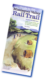 The Missisquoi Valley Rail Trail (MVRT) is Vermont’s first rail trail and it is maintained to serve a wide variety of users throughout the year. The 26.4 mile rail trail has a crushed limestone surface for almost all of its length. The remainder is asphalt. The trail stretches between the full service towns of St. Albans and Richford and passes through several small towns so that food and drink is always close by as is the Missisquoi River. One of the real advantages of a rail trail is that there are no major hills and the maximum grade on this trail is only 3%. The St. Albans end of the Trail is less than 1 mile from the Champlain Bikeway at St. Albans Bay and the Route Verte in Canada may be accessed from the Richford end of the Trail.
Whether you walk, ski, or ride, a trip on the rail trail takes you into the heart of Northern Vermont’s agricultural open lands. The Trail wanders through the farms, forests, fields, and wetlands of Franklin County at a railroad’s pace – slow, steady grades with sweeping bends. For the full length of the Trail, you’ll see the postcard images of Vermont you’ve grown to love. You’ll also see the families and working landscapes that created and support this spectacular scenery.
Free Download:
Guide to the Missisquoi Valley Rail Trail →
Revivez L’aventure de Champlain a Velo
(Live the Experience of Champlain by Bike), 5th Edition
Missisquoi-VRT-FINAL 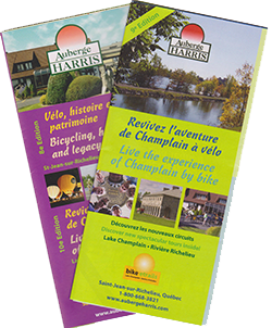 Historie et Patrimoine en Velo provides maps for 11 routes of various lengths totally over 600 km of flat riding between the border and Chambly, QC. These routes connect attractions and historic sites along scenic roads that provide the services that bicyclists need for food and lodging if multi day touring is desired. The best part is that connecting all of these locations are many kilometers of low traffic country roads.
Revivez L’aventure de Champlain a Velo provides several suggested itineraries for trips from St. Jean sur Richelieu to Vermont with a list of camping and lodging options. Detailed directions in both French and English are included with a map covering the Lake Champlain Bikeways territory from Chambly, QC south to Burlington, VT. This map not only shows the suggested routes but all of the other public roads. Almost all of these are great for exploring and enjoying the fun of finding what is around the corner in a beautiful area well suited for bicycle adventure of all types.
Free Download:
Revivez L’aventure de Champlain a Velo →
Southern Theme Loops
Lake Champlain Bikeways in partnership with the Champlain Valley National Historical Partnership has developed a series of six theme loops which are located south of Lake Champlain. A description of the rides and area that they cover along with a map and directions can be found by clicking on the rides below.
Great Sacandaga Lake Bicycle Loop →
Rogers Island Bicycle Loop →
Saratoga Battle Area Bicycle Loop →
Town, lake & Battlefield Bicycle Loop →
The Slate Valley Bicycle Loop →
Two States Bicycle Loop →
Errata – Map Corrections and Points of Confusion
The Way It Is
After completing a trip around Lake Champlain, one rider made us aware of the blog entries that he had created during his trip. With his permission, we are providing a link to that blog because of our belief that he has captured the multiple realities of such a trip. The blog also makes an excellent tour guide by pointing out many things to see and experience and the pictures are beautiful. Every trip is different in detail but they all have common themes which the blog captures. Enjoy it and then go have your own unique experience.